A project for my sophomore year design class to create a map of a space of our choosing that went beyond simple geographic representation and explored a historical, social, or political aspect of the area.
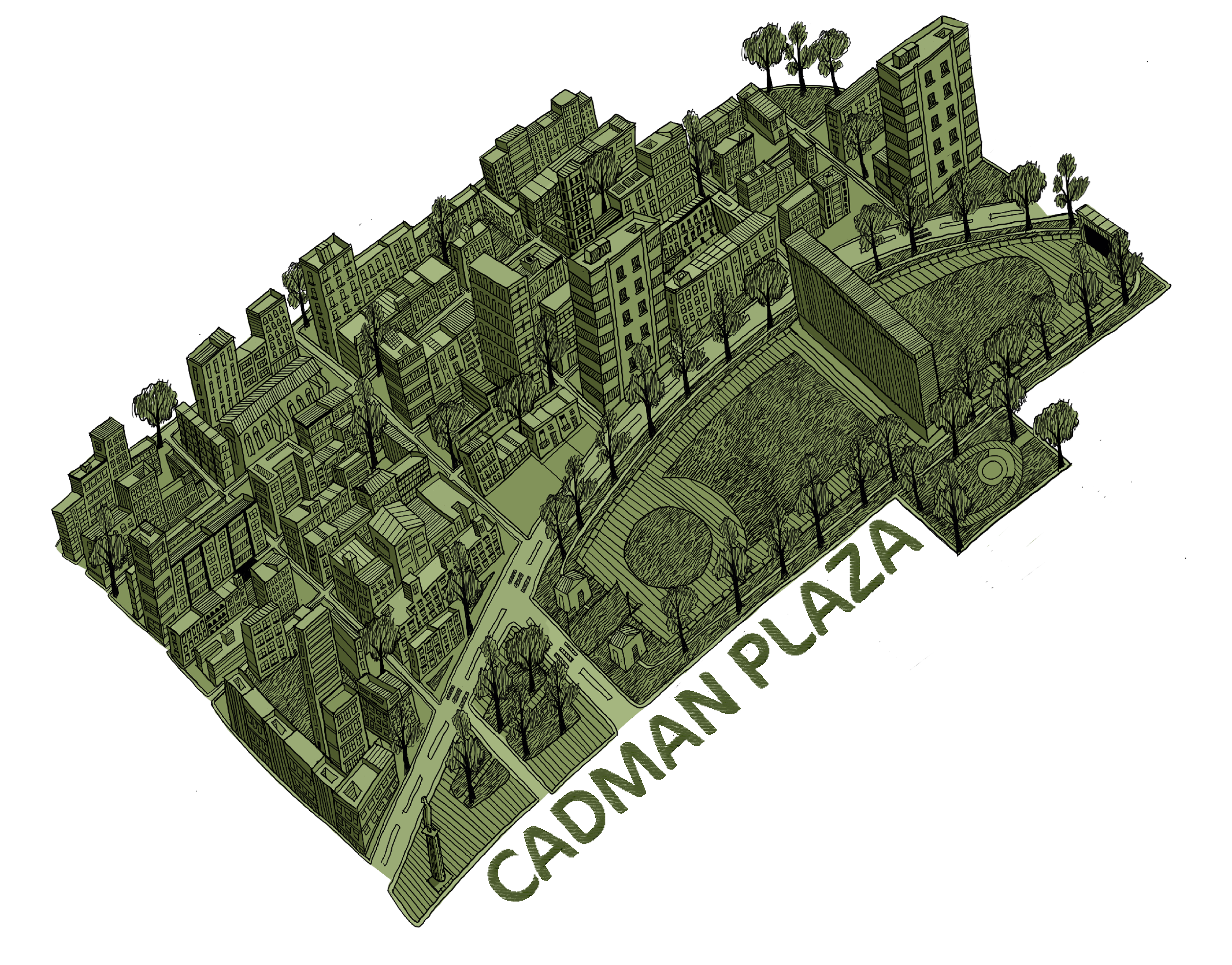
For my project, I chose the Cadman Plaza area in Downtown Brooklyn. What struck me as unique about it was the layer of history and context of the space that existed below the day-to-day happenings of the people in the area.
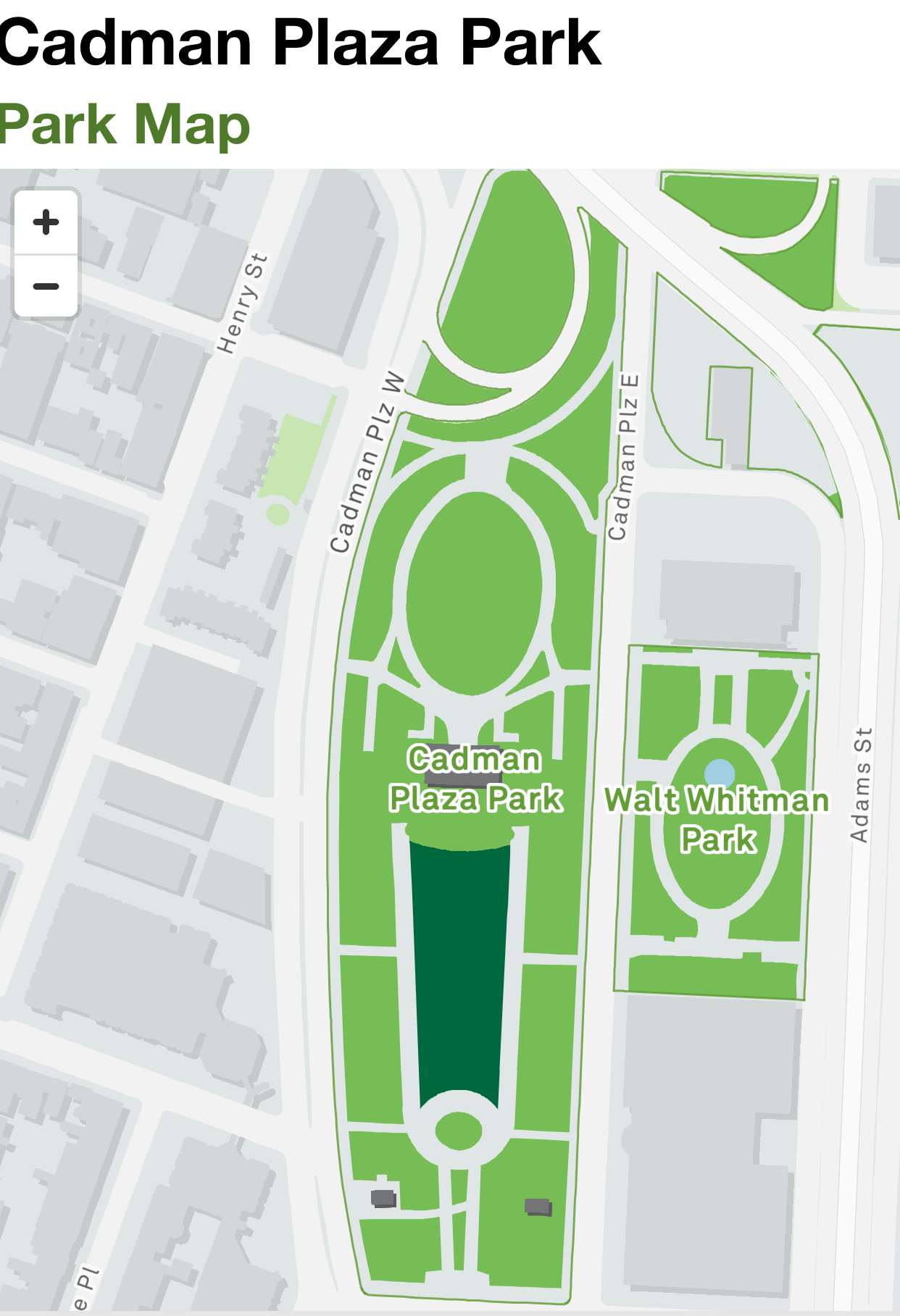
The official map of the park and the area around it said nothing about the changes the area had gone through, its fraught history, or its attractions and places of significance.
Even the locals and residents of the surroundings seemed unaware of the monuments, historical buildings, and landmarks present right in front of their eyes.
I wanted to capture this hidden-in-plain-sight nature of the nearby landmarks of Cadman Plaza in my map.
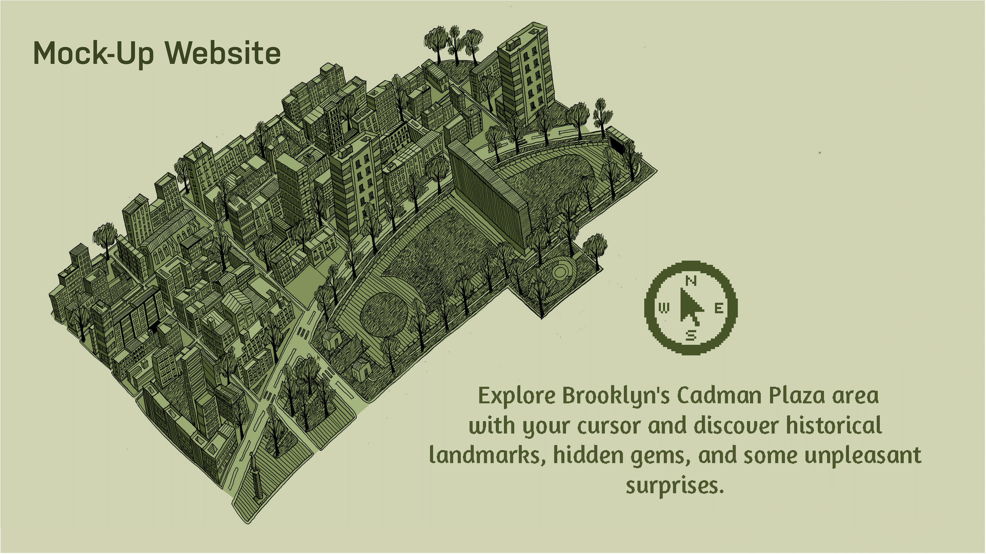
I mocked up an interactive website where the viewer explores the Cadman Plaza area with the cursor of their mouse, and as they hover over a site that has some interesting information associated with it, it blows up with a text blurb.
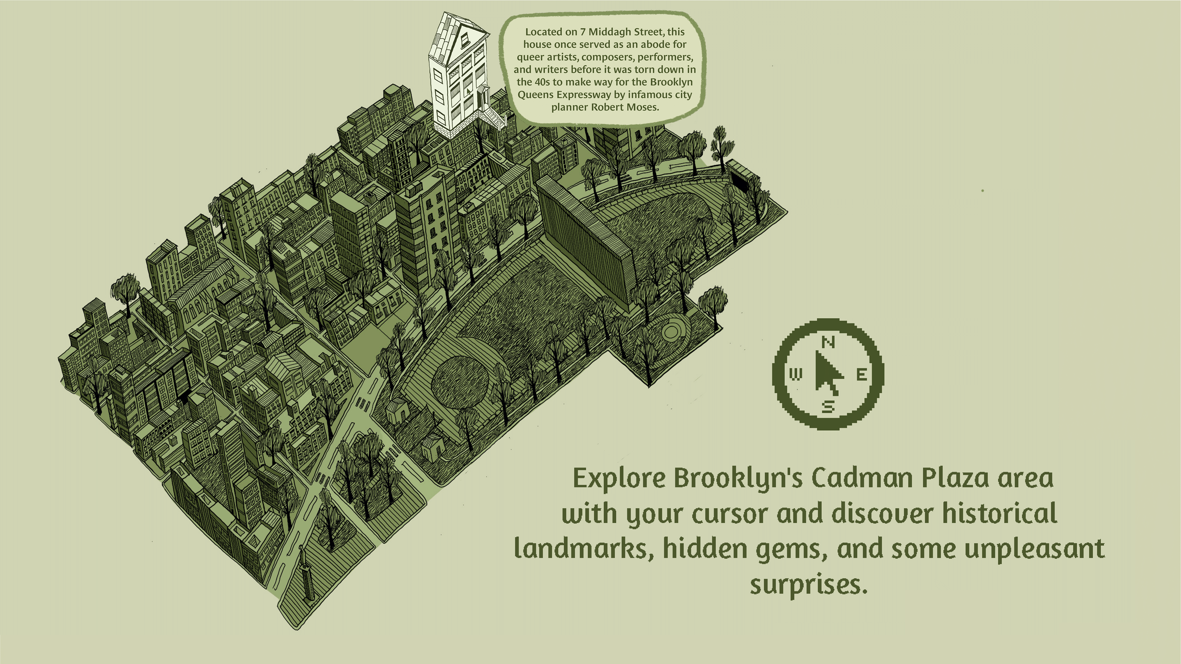
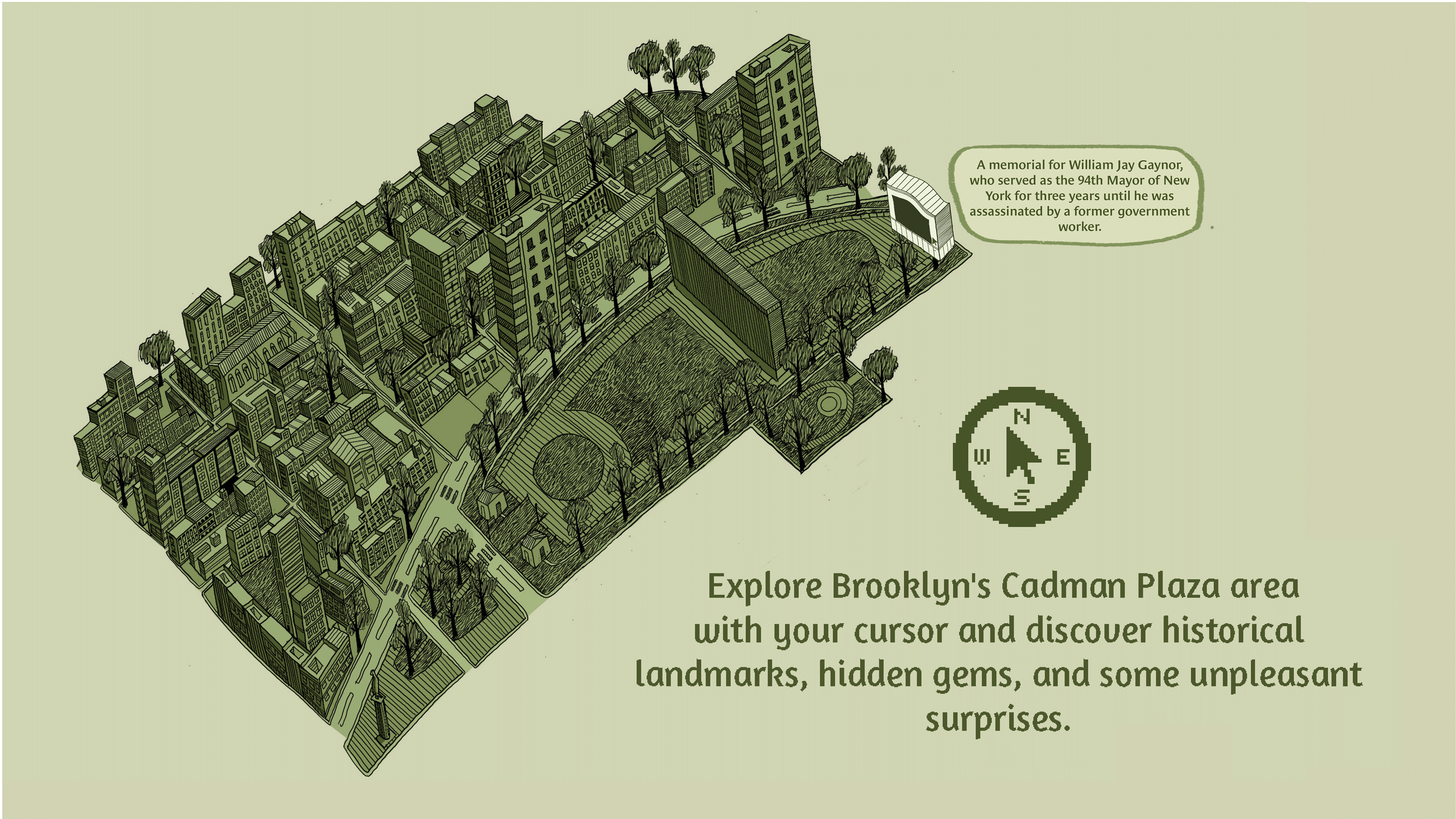
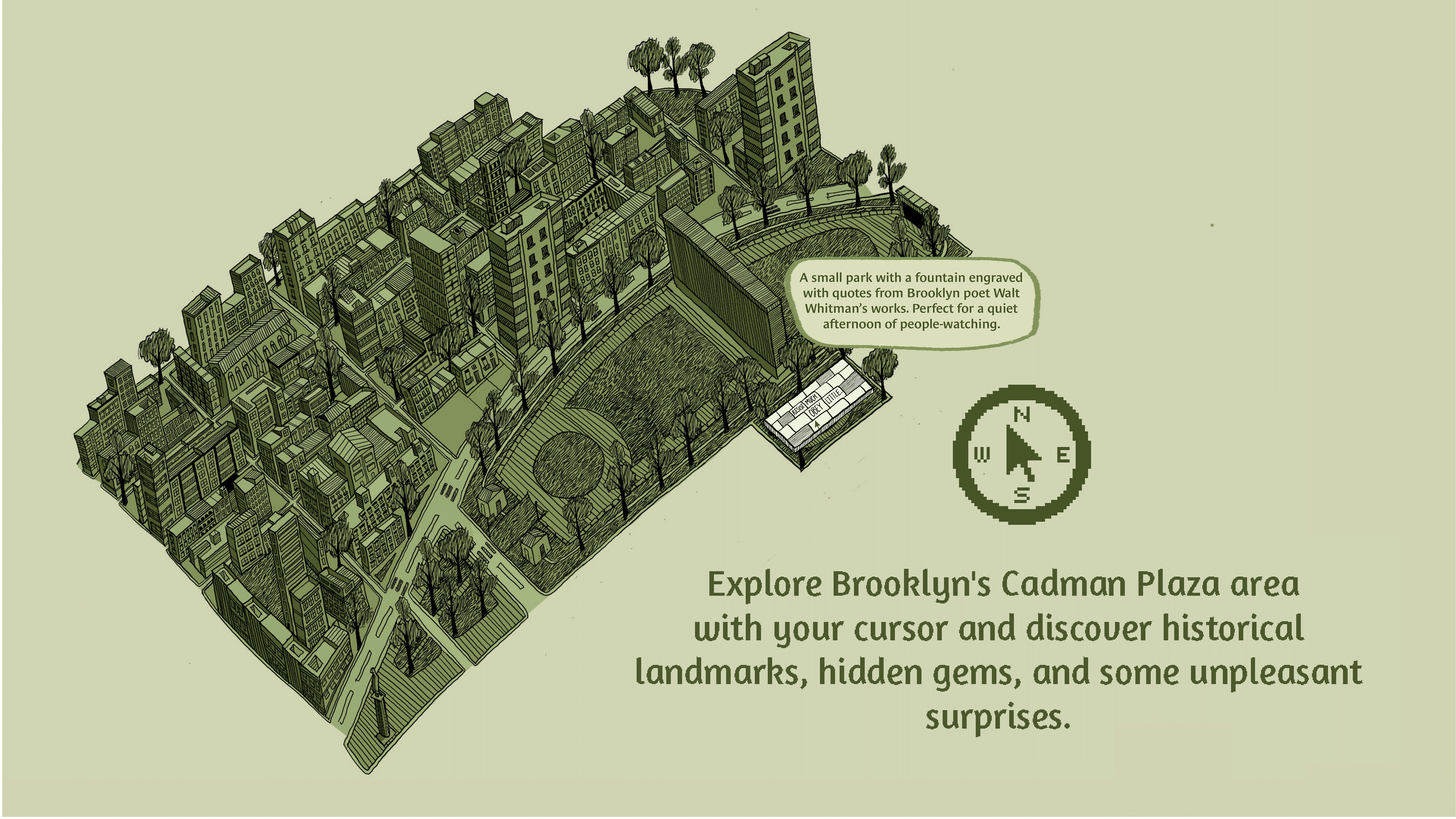
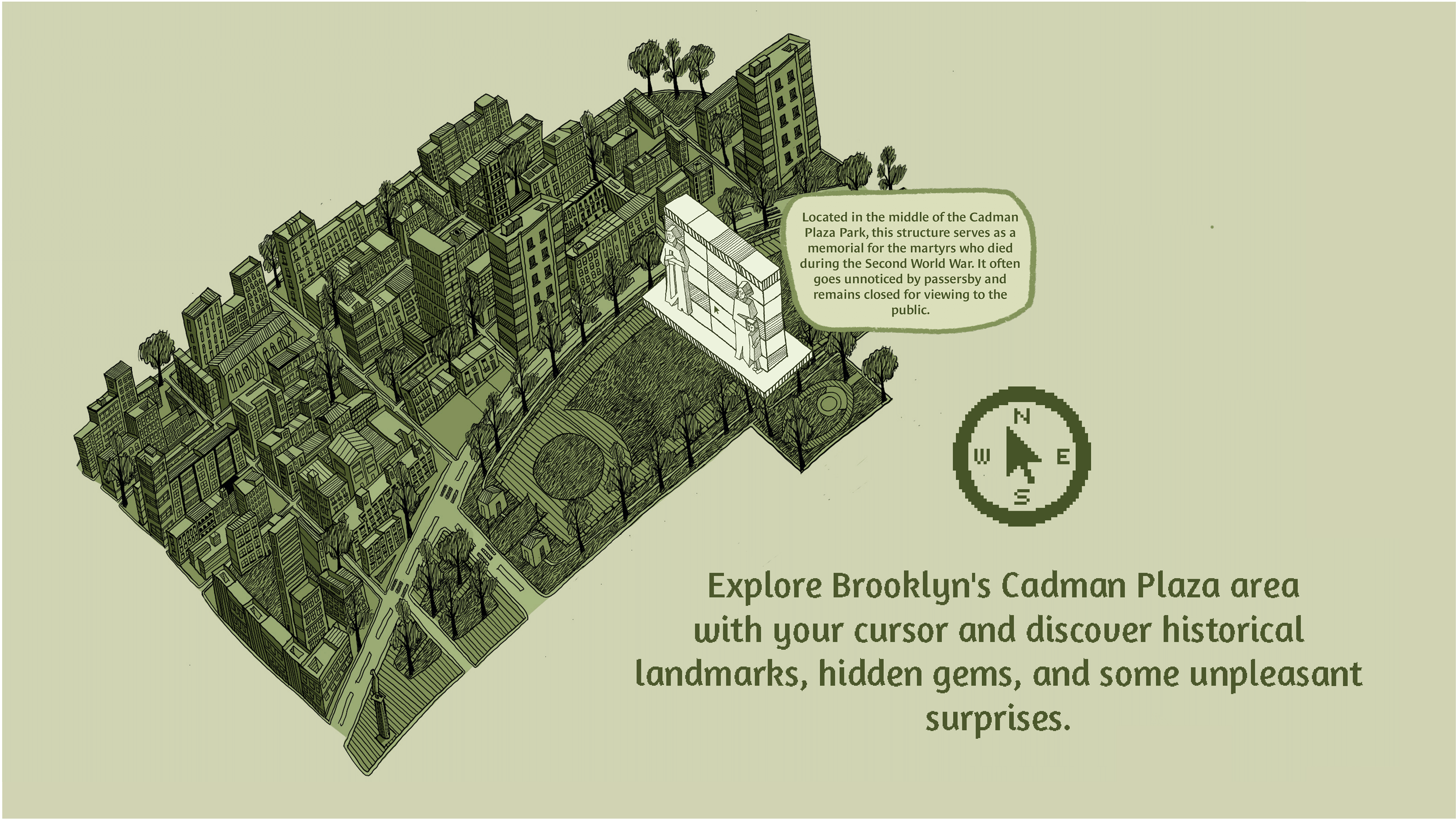
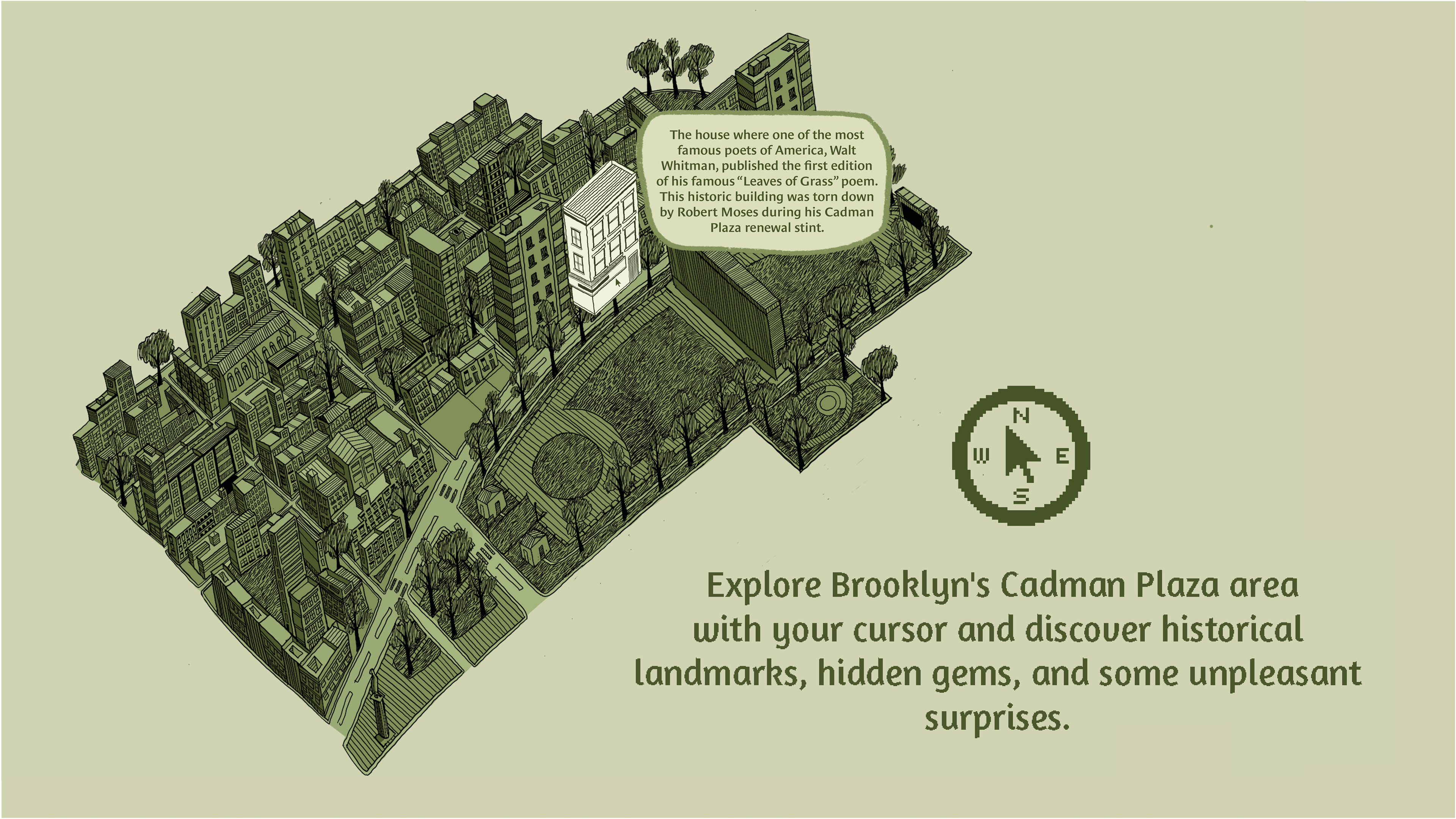
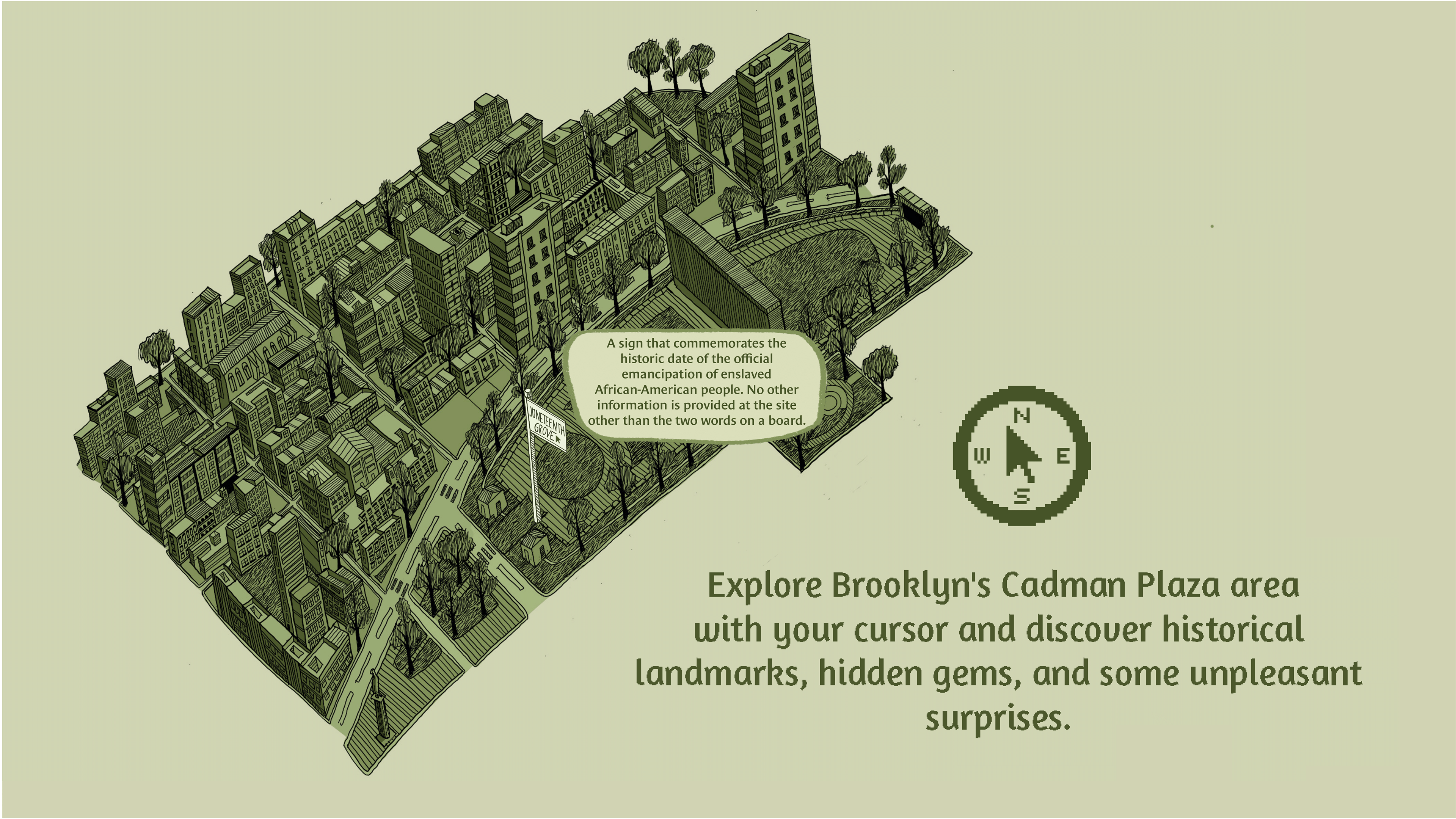
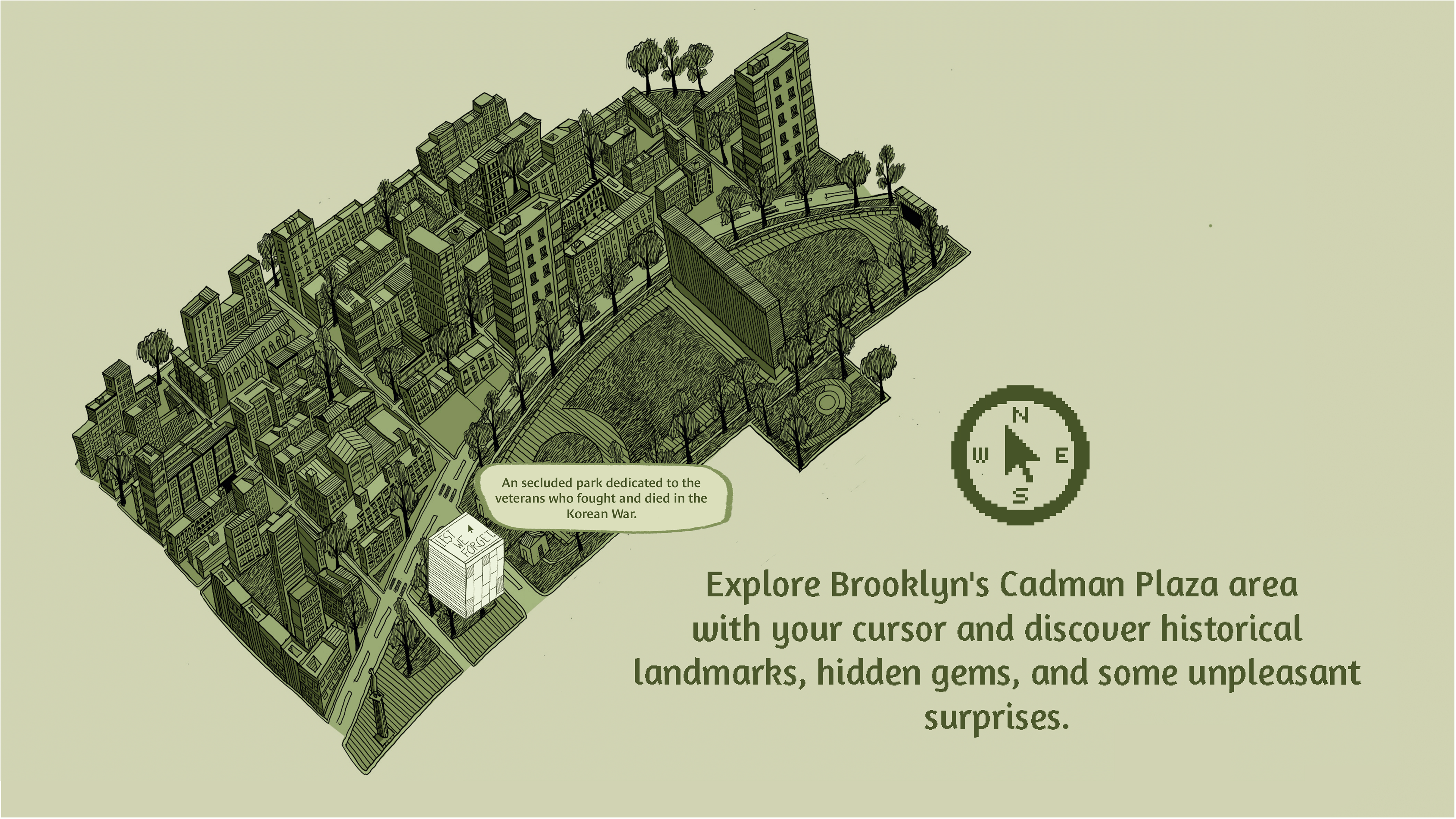
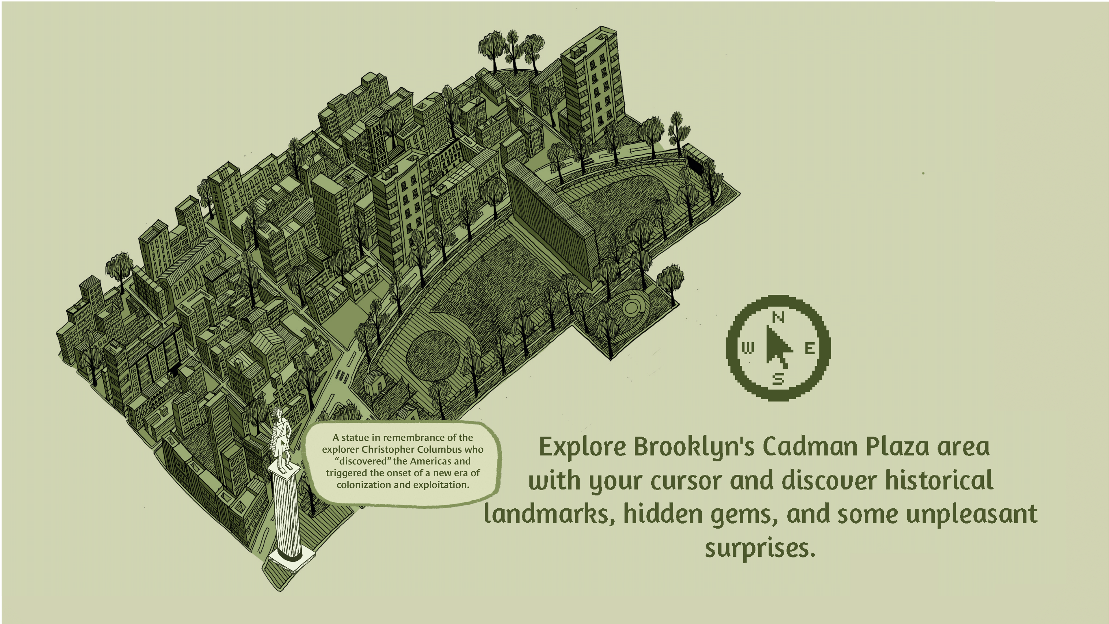
I wanted to mimic how when I first conducted my exploration of the area, I stumbled across many fascinating sites just by "drifting" and not looking for anything in particular.
This project was created with hand drawn illustrations, Adobe Illustrator, and Adobe InDesign.